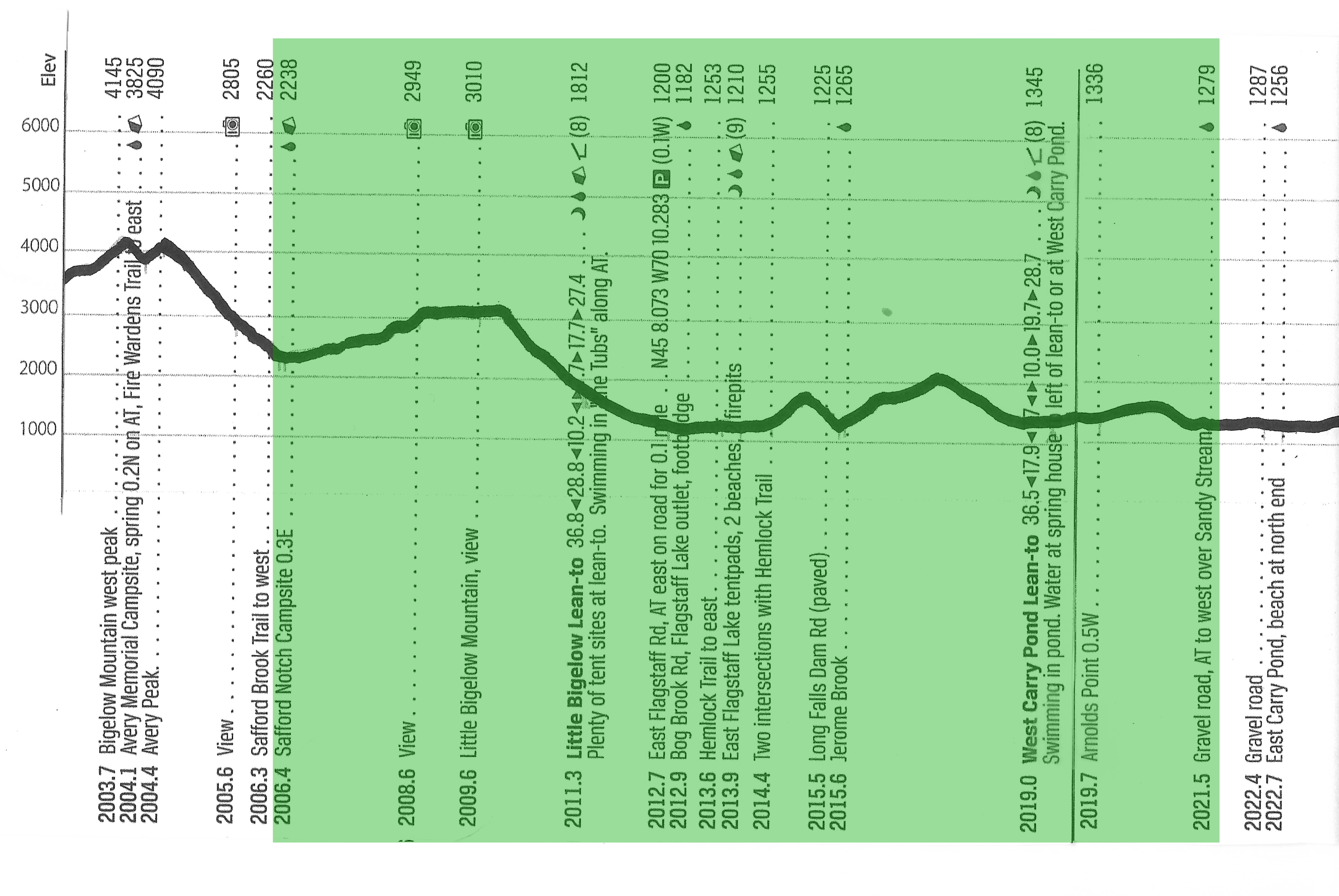
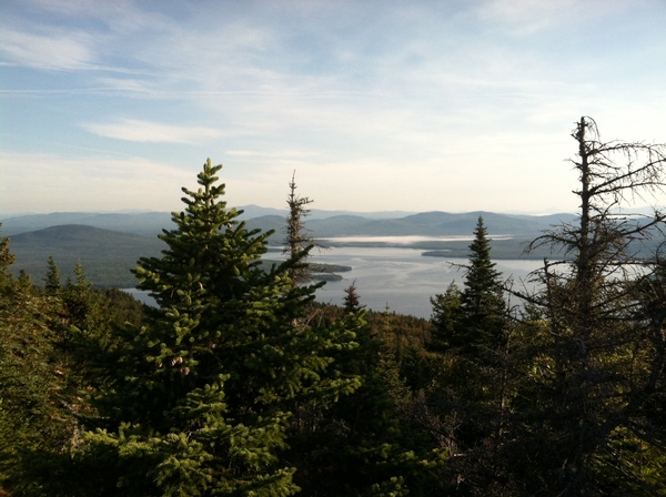
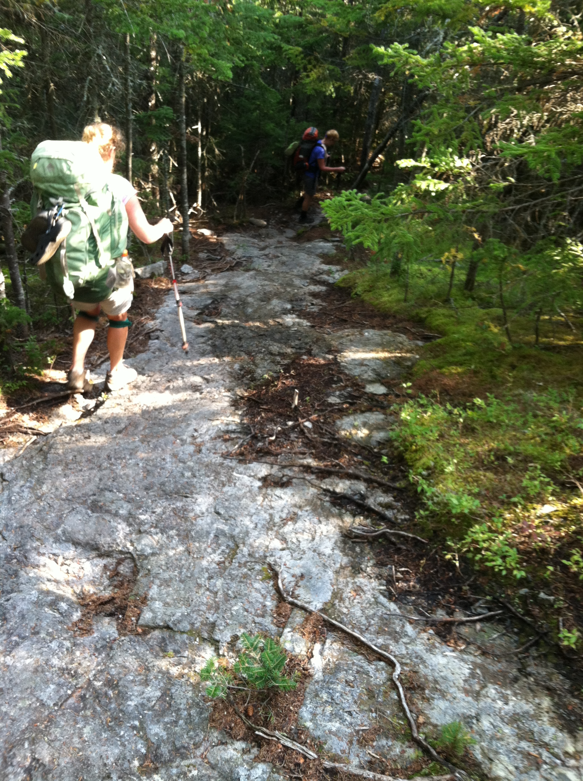
We were hiking at first light, as we had a 3/10 mile walk from our campsite back to the AT. There we began a gradual two-mile, 700′ climb up Little Bigelow Mountain, where we walked the ridge either on a bed of evergreen needles or on wide slabs of exposed rock. We had nice views back to the taller Bigelows and across to the Sugarloaf Mountain ski runs which we had skirted days ago. We watched an early morning float plane fly from the airport below, through Safford Notch, and over to the large manmade Flagstaff Lake, where we lost its view in the mist on that corner of the lake.
After over a mile of hiking on top, we started down toward several road crossings around the lake. Before the turnoff to the next shelter, we met Gyp-C Girl and Spiceman, and then Old Smoke and Log with Yo-Yo, all of whom were slack packing back to Stratton. We heard from Spiceman that his German brother-in-law Rhino was off the trail, after learning two days ago he had two broken ribs he probably injured on a fall back in the White Mountains! This was sad news, as Rhino already had been struggling to finish his hike before his visa expired, and was well liked by the folks in our hiking bubble.
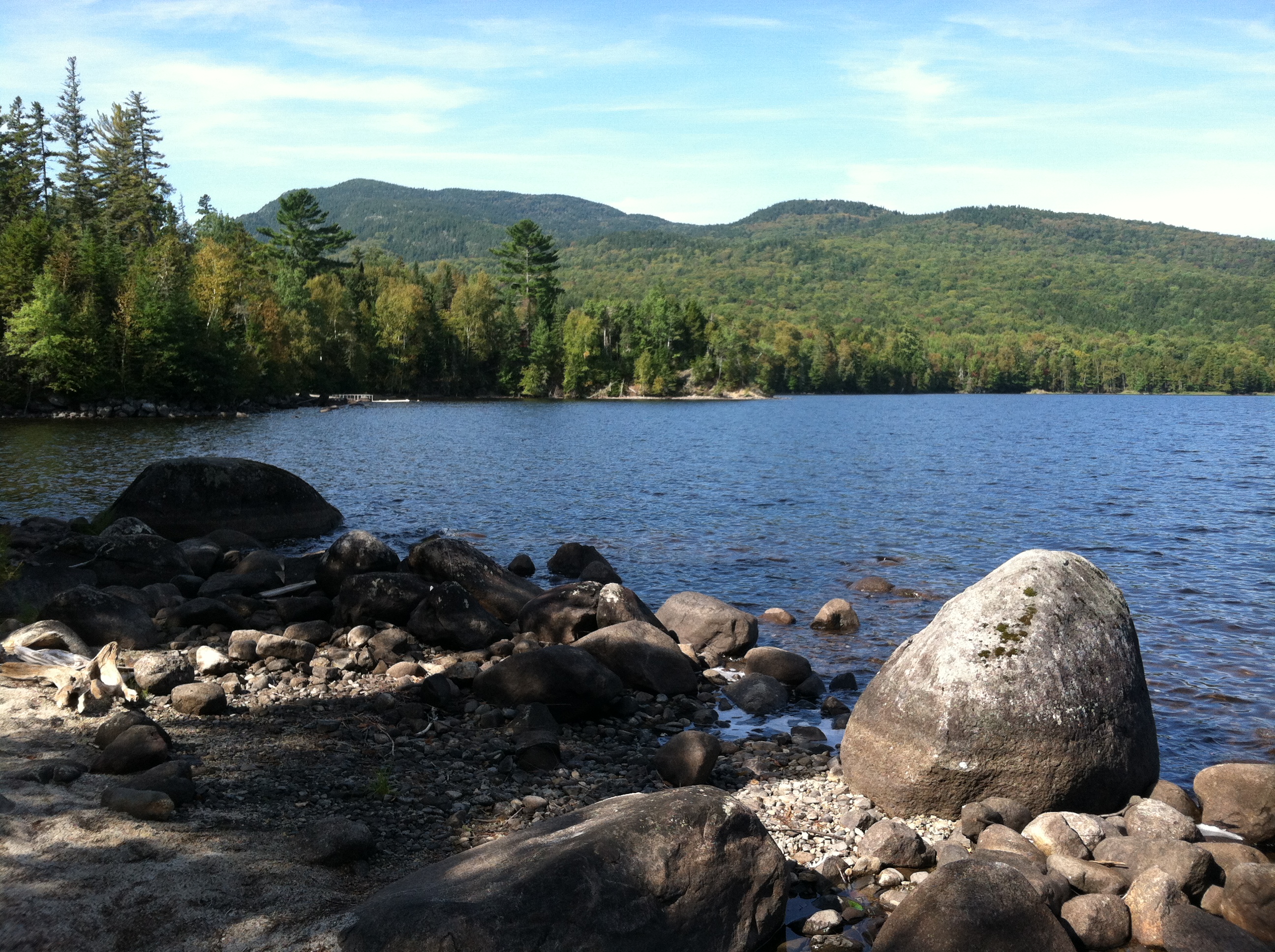
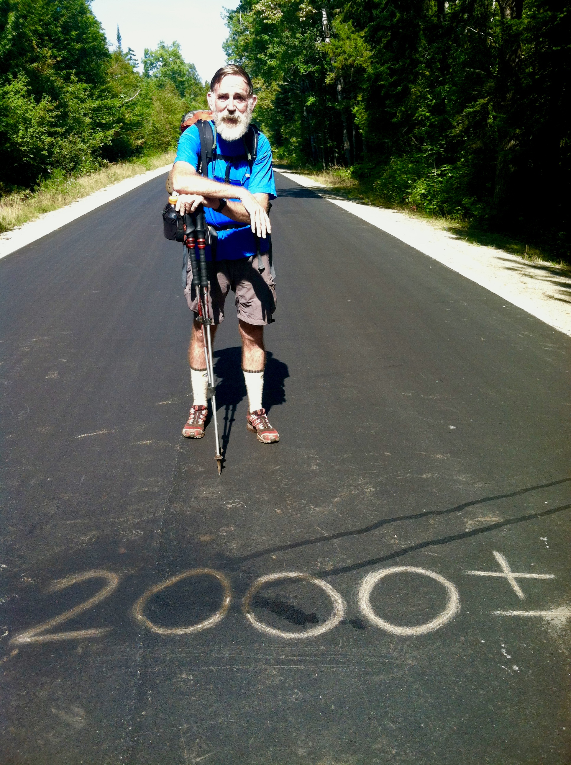
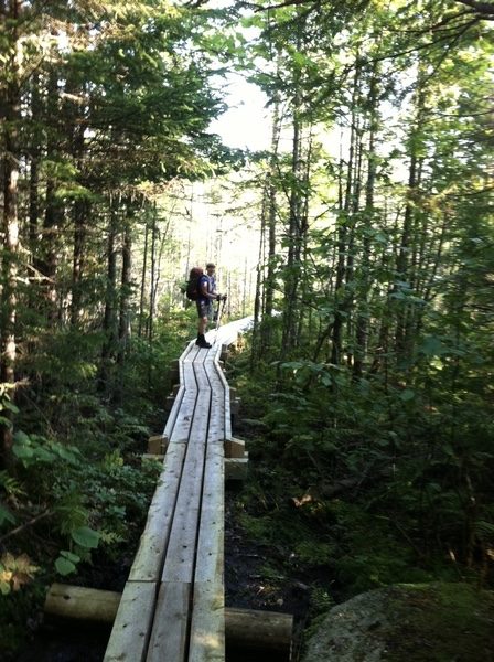
As we had anticipated, the AT got much easier after leaving the Bigelows, and we were able to pick up our pace and make good time walking around the eastern end of Flagstaff Lake (named for the community its creation had inundated). We had one short up and down on an AT re-route, where intersecting parts of the old AT are now used as the Hemlock Trail. We stopped for lunch at the Long Falls Dam Road, where GO Man caught up with us briefly, just as we were leaving. The Long Falls Dam Road crossing is interesting, as although it has recently been resurfaced and is now over 15 miles from the actual location, its former designation as the trail’s 2,000-mile mark has miraculously reappeared with the addition of a plus or minus sign. Sign #4: Just further confirmation a day later we are indeed past two thousand miles!
Although we do not want to rush the end of this wonderful journey/experience, we do need to start planning our last days on the trail. First, we need to coordinate our schedule with the timing of the ferry service we will use to cross the upcoming Kennebec River. The canoe runs only from 9 to 4 with a three-hour lunch break in the middle. Then we have to get our daily mileage back up before the Hundred Mile Wilderness, as every additional day needed there means more food we would have to carry. Finally, as perfect as the weather has been the last two days, we know the chances of nasty weather on Kathadin will increase with the arrival of fall. So, today is a good day to start the beginning of the end…
We know the West Carry Pond Lean-to is too early a stopping point for the day, so as we approach the pond, we ask all the folks we meet about possible stealth sites beyond, where we could pitch three tents. (These southbounders include three section hikers from Murphy, NC, a local couple out for the day, and a flip-flopping couple we see at the shelter, who left Springer Mountain a month after we did, then jumped from Harpers Ferry to Kathadin before starting to hike back.) We decide we can push on at least another 2.5 miles and then start looking for a camp at the next gravel road.
While signing the shelter log, X flips back to find Parkside’s June 15 entry. His tragic drowning death at the next shelter has been the saddest point of this hiking season, and has been frequently on our minds since we heard about it in West Virginia. We will say a prayer for his mother and his hiking family at Pierce Pond tomorrow…
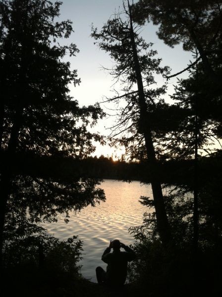
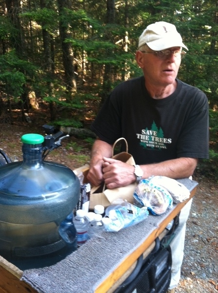
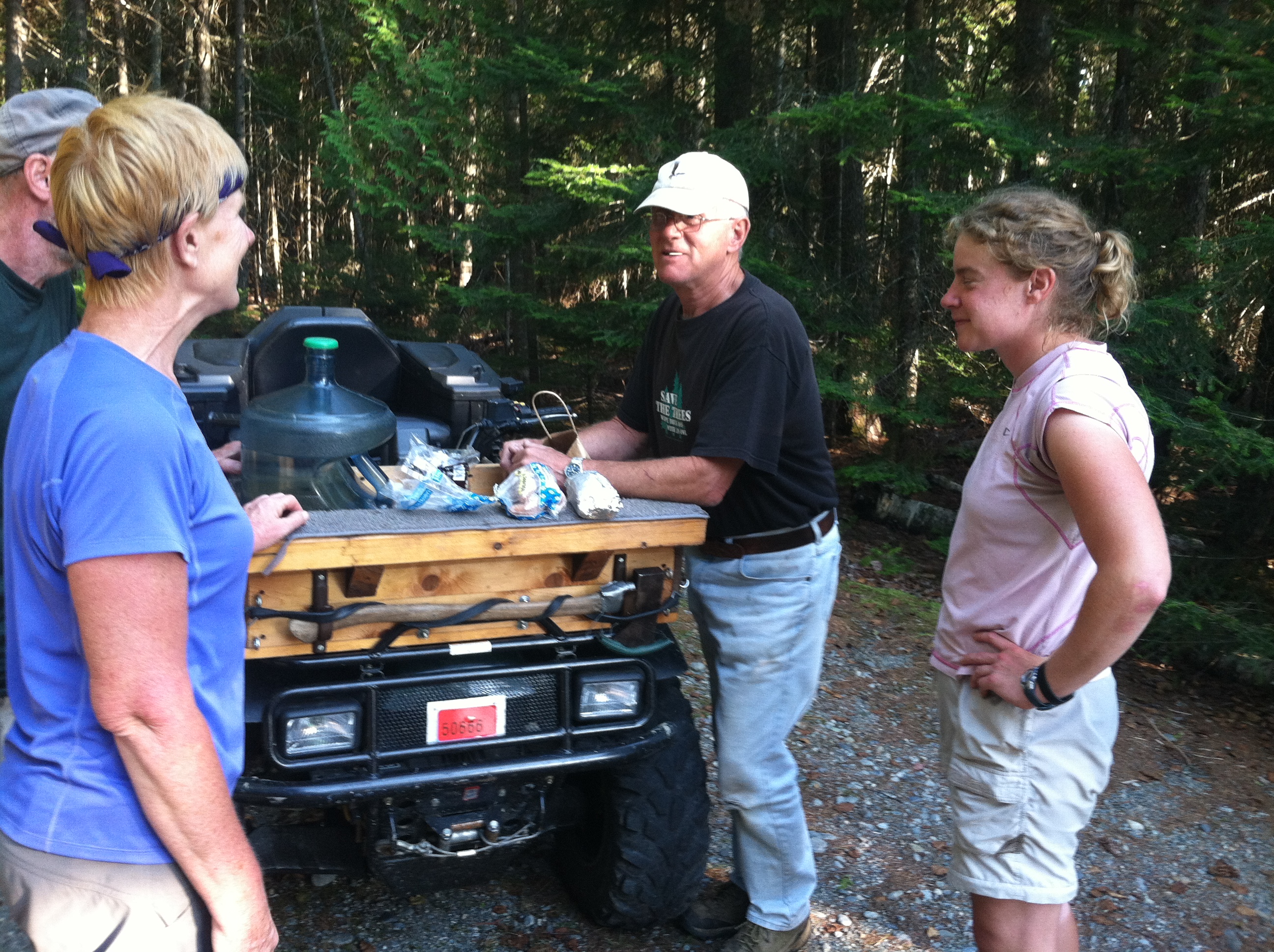
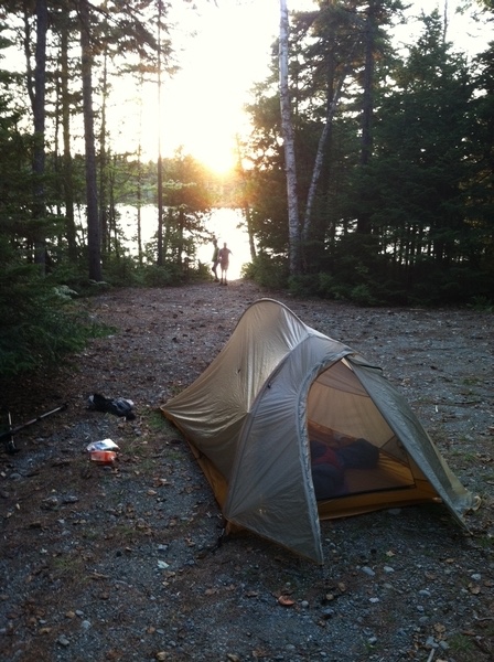
We almost strike out at the next gravel road, where Sandy Stream looks like a terrible water source and tent sites are not to be found. Then up drives Jerry Childs and his wife on an ATV, and all our problems are solved. After a brief conversation, he directs us on a short walk to the next turn where a gravel road takes us down to a wide turn-around at Middle Carry Pond and a great place to camp. As we finish setting up our tents, Jerry arrives with a large five-gallon plastic jug of drinking water (“I wouldn’t drink the pond water even if it was treated.”), sodas, cranberry juice, a few beers, candy, donuts, and his wife’s homemade zucchini bread! He tells us to leave the trash and plastic jug, and he’ll pick it all up in the morning. The Gang of Four feel like they’ve died and gone to heaven! We feast on all these delicacies. We swim in the lake. We listen to the loons. We watch the sunset. We can’t believe all this trail magic! Our deepest thanks to the Childs’ for providing such a marvelous ending to another great day on the AT, complete with the haunting call of a loon soothing us to sleep…